
MONITORING OF GLACIATION AND MELTING IN THE EAST KAZAKHSTAN REGION
https://doi.org/10.48498/minmag.2023.223.11.007
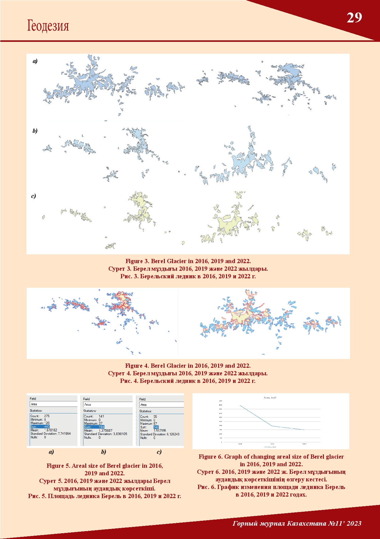
In the scientific field remote sensing as a research tool in the lowland steppes focuses on monitoring vegetation to assess the extent of desertification. However, monitoring individual glaciers would significantly increase the accuracy of the criteria for forecasting areas at risk. This study uses the latest methodology for monitoring glaciers using satellite images of the East Kazakhstan region (Kazakhstan). The approach involves comparing the characteristics (area) of glaciers on satellite images (TM) over a 6-year period (2016, 2019 and 2022). According to the data obtained, the author compared the size of the Berel glacier, which is one of the sources for maintaining the water supply level.
*M. Amirkhanov, Y. Zhakypbek, A. Aben, N. Mussakhan

Magazine subscription
 All your data is confidential and is not distributed to third persons